Global Forest Watch’s 2021 Data Update Explained
©Neil Palmer/CIAT
New data from the University of Maryland (UMD) shows stubbornly high rates of primary forest loss in 2021. What does the data measure, what is different this year and how does it compare to other official estimates of deforestation? Here is what you should know about the new data.
Why we measure tree cover loss and how it can have different impacts in tropical, temperate and boreal forests
Tree cover loss is defined as the removal of tree cover for any reason and may be permanent or temporary. Contrastingly, deforestation refers only to permanent land use change. (Read more here about what is — and isn’t — included when we discuss tree cover loss.) The UMD data measures loss of all trees taller than five meters, which can include loss in primary forests and recovering secondary forests, and harvesting in established tree plantations.
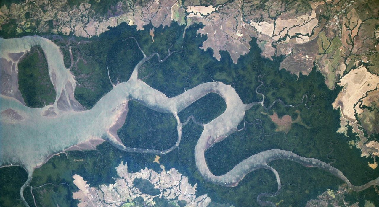
When we analyze the data, we largely focus on humid tropical primary forests, areas of mature rainforest that have high carbon and biodiversity value that take decades to recover after a loss. Tropical forests experience the vast majority of deforestation while loss in temperate and boreal forests is mostly temporary — caused by wildfires and forest management for timber. Focusing much of our analysis on loss in tropical primary forests allows us to shift our focus away from this temporary loss. However, this year we also found notable trends in boreal forests that were worth exploring. Wildfires are a natural part of boreal ecosystems, but frequent and more intense fires, as well as loss caused by insect damage, are increasingly common and linked to hotter and drier conditions due to climate change.
But looking at the tree cover loss data alone doesn’t tell us the underlying driver of the loss. Additional data on drivers, commodity linked deforestation and now fire tell us more about the causes of loss.
For the first time, we can assess detailed patterns of tree cover loss due to fire
New data from UMD assigns likelihood of loss due to fire to each 30-meter tree cover loss pixel, breaking the data into loss due to fire and loss due to other drivers, such as agriculture or logging. The new tree cover loss due to fire data includes natural or human-ignited fires that result in direct loss of tree canopy cover. The data captures wildfires, fires used to clear land for another use and intentionally set fires that result in tree cover loss (including escaped fires started by humans for purposes related to agriculture, hunting, recreation or arson). Instances where trees are felled and later burned are not included however, since the initial driver of loss is mechanical removal.
This data allows us to better understand how fire impacted the 2021 loss data. In some places, the interannual variation of loss from fire can obscure the longer-term trend in permanent deforestation. For example, when looking at all primary forest loss in Brazil, there is a downward trend from 2020 to 2021. But 2020 was an active fire year in Brazil, and when we separate loss due to fire from other losses, we see that there was actually an increase in non-fire losses from 2020 to 2021. This matches official data from Brazil — read more below about how identifying loss due to fires helps us better compare the two data sets.
Even though fires often do not result in a permanent change in land use, they are still an important source of carbon emissions and can lead to feedback loops of increasing emissions, drier forests and more fires.
We’ve just scratched the surface of insights from this important data set. The full data set and more insights will be released on GFW in the coming months.
The UMD data mirrors official deforestation estimates from Brazil
PRODES — the official Brazilian government forest monitoring system for the Amazon — and the UMD data have methodological and definitional differences that are important to understand when comparing these two data sources. PRODES measures clear cut deforestation larger than 6.25 hectares, whereas UMD captures loss larger than 0.09 hectares of all trees taller than five meters. These are both important measures that help us understand how forests are changing since deforestation, forest fires and small disturbances to forest canopy can all lead to impacts on climate, biodiversity and ecosystem services.
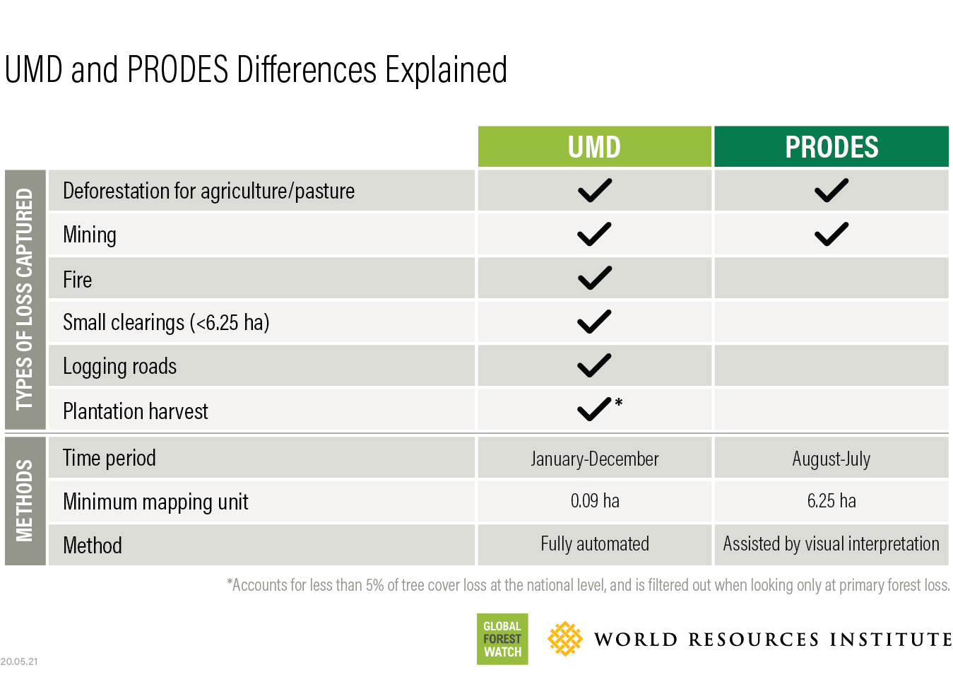
Previously, we have also examined the differences between UMD and official deforestation data from Indonesia. Official data for 2021 was not available at the time of this publication, but previous comparisons can be found here.
At first glance, PRODES and the UMD data seem to show different trends for 2021: PRODES shows a 22% increase in forest loss during the last reporting period (August 2020-July 2021) while UMD shows a 6% decrease in primary forest loss in the Amazon for January-December 2021. However, the new fire data allows us to filter out losses due to fire from the UMD data set, enabling a fairer comparison of these two data sets. Doing so results in more comparable estimates of forest loss trends over time, showing converging trends and similar extent of loss in the two data sets. For 2021, the UMD data shows a 10% increase in non-fire primary forest loss in the Amazon, much closer to PRODES’s 22%. In addition, the spike in loss in the UMD data for 2016 and 2017 can largely be attributed to understory fires, and disappears when considering only non-fire losses.
PRODES vs. UMD data in the Brazilian Amazon
Data improvements over time result in inconsistencies in the data before 2015
Algorithm adjustments and better satellite data have improved the tree cover loss data set over time. Changes to the tree cover loss detection algorithm for the years 2011-2014 and 2015 onwards and the incorporation of Landsat 8 data starting in 2013 make it easier to detect smaller scale changes, such as loss due to fires, selective logging and shifting agriculture. Variations in satellite image availability also mean there are inconsistencies with the quality and number of images available to capture data each year. Clouds and smoke from fires can also delay tree cover loss detection, which can result in tree cover loss being picked up in a year after it occurred.
To address these issues, we:
- Focus our analysis on trends post-2015
- Always assess the three-year moving average
- Are especially careful in places dominated by small-scale agriculture where the data improvements are particularly noticeable, like Central Africa
More data improvements are in the works that will apply a consistent algorithm across all years for which we have data and help us assess longer term trends in the data.