- Insights
Exploring Indonesia’s Long and Complicated History of Forest Fires
Feb 02, 2017||4 minutes
Languages
By Andres Chamorro, Susan Minnemeyer and Sarah Sargent
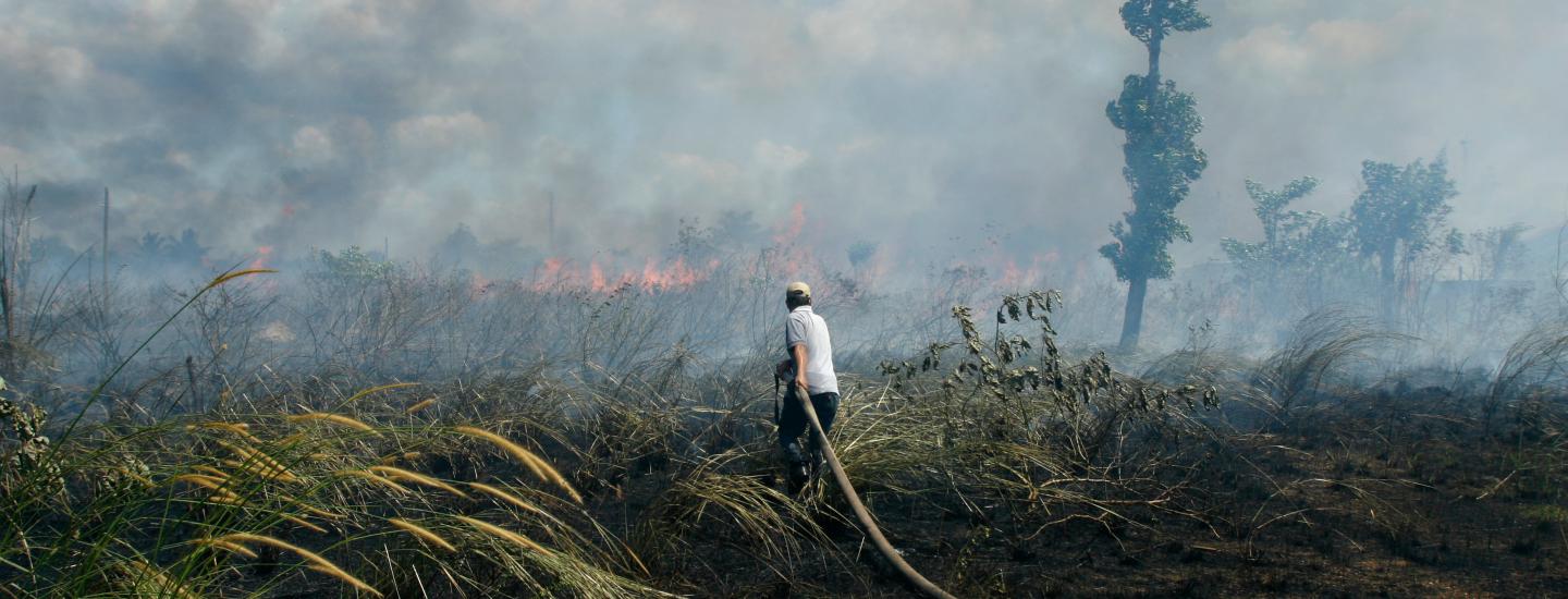
For decades, forest and land fires in Indonesia have been an annual environmental crisis, but the dry conditions caused by the 2015 El Niño made that year’s fire season the worst in twenty years: approximately 2.6 millions hectares of land were burned between June and October—Indonesia’s dry season. The fires, many burning on carbon-rich peatlands, exposed millions of people across Southeast Asia to toxic haze and tripled Indonesia’s annual greenhouse gas emissions.
This year we have not seen nearly as many fires because of wetter conditions, but the root of the problem still needs to be addressed. Nearly all fires in Indonesia are human-caused. The country’s forests and peatlands—carbon-rich, water-logged landscapes that have become another popular option for agricultural expansion—are too moist for fires to ignite naturally. Therefore, they are typically actively drained and set aflame to prepare for agriculture or drive people away in land conflicts. An analysis of new fire history data on Global Forest Watch Fires (available for download here) confirms that fires tend to be concentrated on agricultural concessions and peatlands in Indonesia.
Seeing where fires occurred in the past can help inform fire prevention efforts, like companies’ no-burn commitments, government land use and restoration strategies, or village-level fire prevention programs to the areas of greatest need. This data show the yearly concentration of fire alerts detected by NASA’s MODIS satellites between 2001 and 2015. High concentrations of fire alerts are represented as red spots, while low concentrations are shown in blue.
Click on different provinces on the interactive map to see the number of fire alerts and where they occurred. You can also hover over the bar chart to see the fire alerts breakdown by year.
South Sumatra, Central Kalimantan and Riau Most Fire Prone Provinces Due to Agriculture
Over the last 15 years, the majority of fires in Indonesia happened in South Sumatra, Central Kalimantan and Riau. Together, these three provinces account for 44 percent of all fires in Indonesia since 2001. In the 2015, the fire alert count in Central Kalimantan and South Sumatra surpassed 27,000, compared to the 5,500 alerts each province had on average in the previous five years. In Riau, fires are decreasing overall, but 4,058 fires were detected in 2016, despite it being a wet year. That’s more than four times as many fires than were detected in the fire-prone Central Kalimantan and South Sumatra.
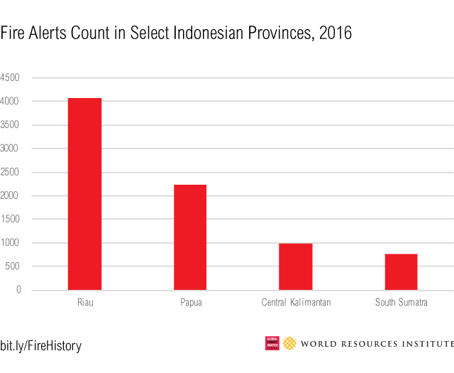 Despite 2016 being a wet year, the Riau province experienced four times as many fires at the historically fire prone provinces of Central Kalimantan and South Sumatra.
Agriculture has been the single biggest driver of these fires. More than 60 percent of the 2015 fires in Central Kalimantan and South Sumatra occurred on peatlands. In South Sumatra, 50 percent of its fires in 2015 were also on pulpwood and wood fiber concessions. 2016 fire alerts data shows that this pattern persisted in Riau, where 47 percent of the fires that year were within wood fiber concessions. Looking back further, Central Kalimantan has had more fires alerts on oil palm concessions than any other type of land in every year since 2001. The data also show that historical fire patterns may be changing. The Papua province, for example, has seen an uptick in fires in recent years. In 2015, fires alerts spiked to 14,500, compared to an average of roughly 3,200 fire alerts each year between 2001-2015. With more than 35 percent of fires detected since 2001 occurring inside protected areas and illegal burning on the rise, its relatively untouched forests are becoming increasingly threatened.
Preventing Future Fires
These fire history data offer clues as to where and what kinds of fire prevention efforts may be most effective in helping Indonesia avoid disastrous fire seasons in the future, including:
- Prioritizing no-burn and zero-deforestation commitments in provinces with chronic fires, where the clearing of forests and peatlands for agricultural expansion needs to be contained. Moreover, companies that have already announced such commitments need to deliver not only within their concession boundaries, but also develop strategies to ensure this commitment is followed across their entire supply chains.
- Closely monitoring provinces with intense recent burning, such as Papua. The new moratorium on all peatlands will be crucial to preventing fires in relatively unexploited forests.
- Focusing restoration efforts in provinces with a long history of burning. The Peatland Restoration Agency, a new government-led effort to restore the hydrology of peatlands, should begin in South Sumatra and Central Kalimantan. Additionally, implementation and enforcement of the new peatland moratorium, which requires companies to restore peatlands they have drained in the past, should be especially stringent in those provinces.
- Analyzing fires more granularly in Sumatra and Kalimantan will help the Fire Free Alliance, an initiative of plantation companies and NGOs focused on fire prevention, decide where to scale up successful village-level initiatives, such APRIL’s Fire Free Village Program in Riau Province.
Looking into the past can help Indonesia avoid repeating its history of devastating annual fire seasons. Together with increasingly accurate, near real-time data coming online, the fire history data may help break the cycle.
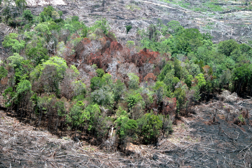
This post also appears on Insights. Fire History Data is available for download here. BANNER PHOTO: Land clearing for oil palm expansion by means of fire (Landak, West Kalimantan). Credit: Wakx (Flickr). License information here.
Explore More Articles

Explore More Articles


