Filter by category and topics
SHOWING 6 OF 174 POSTS
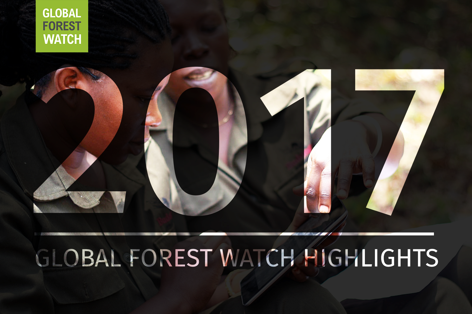
Private: A Year in Review: Global Forest Watch Highlights from 2017
It’s been another busy year for Global Forest Watch! This year we focused on putting the right data into the hands of our users to support action on the ground. We added more local data and made it easier than ever for decision-makers and on-the-ground forest monitors to access the information they need through national […]
Private: Actualización: Alertas GLAD disponibles ahora para 6 países más de la Amazonía
Las alertas de deforestación GLAD, generadas por la Universidad de Maryland, se encuentran ahora disponibles para seis países adicionales en la Amazonía: Colombia, Ecuador, Guyana Francesa, Guyana, Surinam y Venezuela. Ver en el mapa de Global Forest Watch. Con esta más reciente actualización, aumentamos de 16 a 22 países para los cuales existen alertas GLAD. […]
Private: UPDATE: GLAD alerts now available in 6 more northern Amazon countries
The weekly GLAD deforestation alerts from the University of Maryland are now available for an additional six countries in the northern Amazon: Colombia, Ecuador, French Guiana, Guyana, Suriname and Venezuela. View on the Global Forest Watch map. That brings the number of countries with GLAD alerts from 16 to 22. Amazon Central Africa Southeast Asia Brazil Burundi Brunei *Colombia […]
Private: UPDATE: GLAD deforestation alerts are back
We are happy to report that the weekly GLAD deforestation alerts from the University of Maryland are back online for the Amazon, Central Africa and insular southeast Asia. They’re available for the following countries: Amazon Central Africa Southeast Asia Brazil Burundi Brunei Peru Cameroon Indonesia Central African Republic Malaysia Democratic Republic of the Congo Papua […]
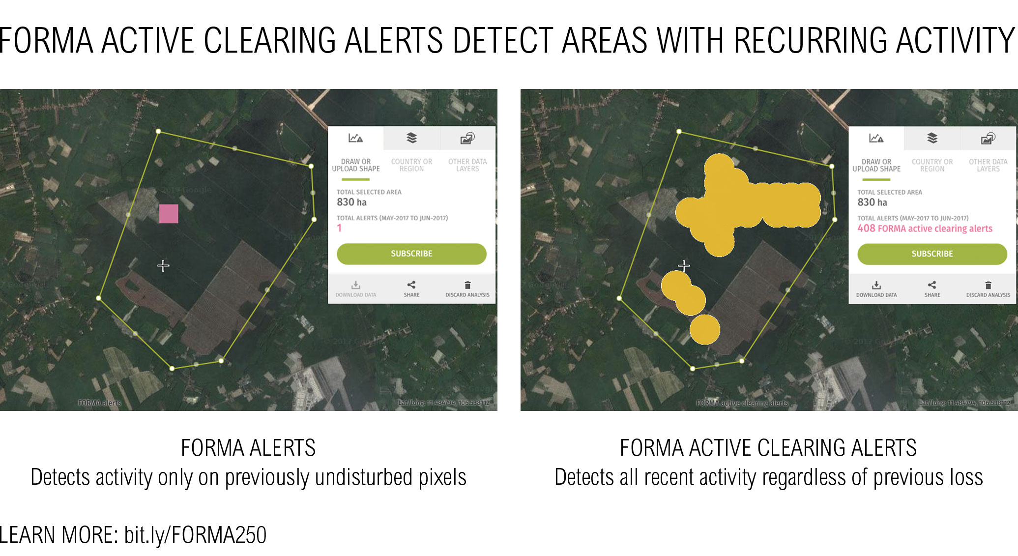
Private: FORMA250: Global Forest Watch’s original near real-time alert system gets an upgrade
By Brookie Guzder-Williams When Global Forest Watch launched, FORMA (FORest Monitoring for Action) 500 was our first and only near real-time alert system. By analyzing NASA satellite images, FORMA 500 gave monthly updates of tree cover loss (the death or removal of trees, regardless of cause) across the forests of the moist tropics at 500 […]
Private: UPDATE: High-resolution satellite imagery is back on GFW
Since March, high resolution satellite imagery has been unavailable on Global Forest Watch while we switched service providers from UrtheCast to Sentinel Hub to ensure continued global coverage. We wanted to thank you for your patience during this process, and update you with the exciting news that you can now once again access high-resolution satellite imagery on GFW! View this spot on the GFW interactive map. Sentinel Hub provides the latest Landsat 8 and Sentinel 2 […]


