- Forest Insights
What Indonesia Doesn’t Know About Peatlands Could Undermine its Climate Goals
Languages
By Hidayah Hamzah and Reidinar Juliane
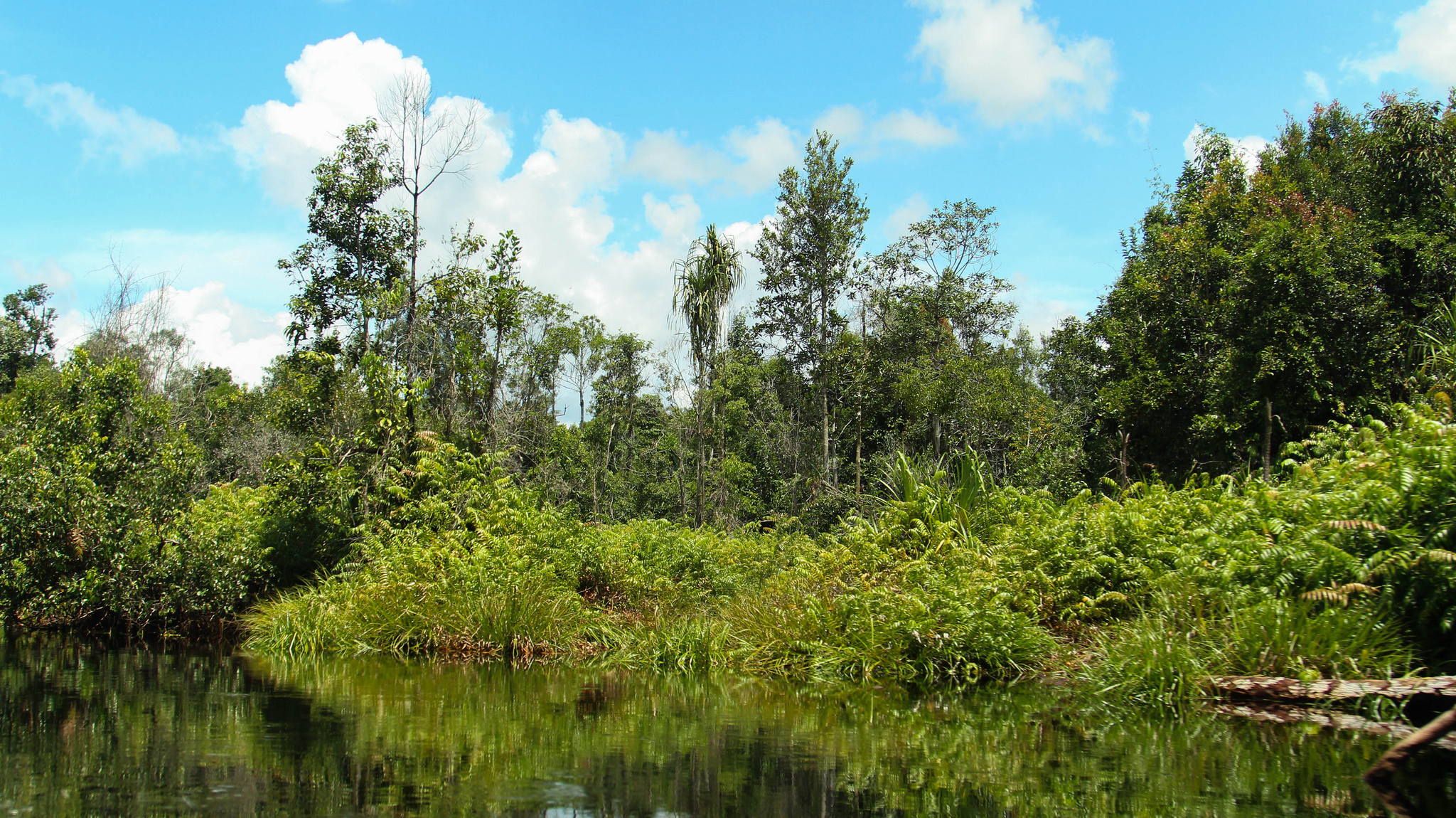
 Peat swamp forests of the Katingan Peatland Reserve in Central Kalimantan, Indonesia. Photo by James Anderson/WRI (Flickr).
Peat forests, or wetlands, are some of the most important ecosystems for Indonesia and climate change. The country holds the largest tropical peatland in the world, which acts as a major carbon sink. At the same time, carbon emissions from peat decomposition and peat fires account for 42 percent of Indonesia’s total emissions, and spikes in peat fires in 2015 pushed the country to move from world’s sixth-largest to the fourth-largest emitter. Yet for how important Indonesia’s peatlands are, we know surprisingly little about them—much of the information out there about their extent, their thickness and how they’ve changed is inaccurate. Getting more details about these ecosystems is imperative for helping decision-makers protect them and for achieving Indonesia’s emissions-reduction goals.
What We Don’t Know: Outdated Maps
Indonesia has several existing peat maps issued under the Regional Physical Planning Programme for Transmigration (RePPPRoT) program (1989), Wetlands International (2004) and Ministry of Agriculture (2011). The map issued under RePPPRoT in particular has been used by many government and non-governmental institutions such as the Ministry of Agriculture and the Ministry of Environment and Forestry as a reference to develop and update their own maps. However, while these maps do contain information on peat extent and thickness, they lack critical information necessary for properly managing peatlands and curbing emissions from them. In particular:
1. They’re not high resolution
Indonesia’s current national peat map has a scale of 1:250.000, which means 1 centimeter on the map is equivalent to 2.5 kilometers (1.6 miles) on the ground. This scale is sufficient to be referred to for national-scale planning, such as for developing the national forest moratorium map, which outlines areas closed to new concessions as part of efforts to curb deforestation. However, local-level planning decisions, such as water table management, require more detailed maps with higher resolution. A scale of 1:50.000 (1 centimeter on the map equals 500 meters (1,640 feet) on the ground) is necessary for this sort of planning and management.
2. They don’t contain accurate information on peat thickness.
Information on peat thickness is essential for peatland management to be able to specifically determine potential areas to be conserved and utilized. For instance, the national regulation on protection and management of peat ecosystemsstipulated that peat conservation areas should be determined by the existence of peat thicker than 300 centimeters (118 inches). The thicker the peat, the greater carbon it stores. However, existing maps lack accurate information on peat thickness, hence undermining peat management efforts and presenting difficulties in tracking the changes in thickness over time.
3. There’s no accepted methodology for measuring peat thickness.
Scientists have used remote sensing, radar and on-the-ground measurement to estimate peat extent and thickness in the past. However, there is no agreed-upon, uniform method for peat mapping, particularly for measuring thickness. This lack of consensus has hindered the efforts to create the most robust, timely and credible map that can track changing peat extent and thickness, and the associated carbon emissions.
A Better Method for Mapping Peat
Responding to this urgent concern, the Geospatial Information Agency (Badan Informasi Geospasial/BIG) in partnership with WRI Indonesia and other organizations recently launched the Indonesian Peat Prize. The competition calls on scientists around the world to develop a more accurate, faster and scientifically based methodology of mapping Indonesian peat extent and thickness. The winner of the competition will be announced in Summer 2017. The result of the competition will hopefully be a transparent, credible and location-agnostic methodology for mapping Indonesian peat extent and thickness that will also contribute to the revision of a national standard for peat mapping in Indonesia. As Indonesia’s Environment and Forestry Minister Dr. Siti Nurbaya Bakar said at the Prize’s launch event, the outcome is expected to help resolve methodological uncertainty as well as provide accurate data required for managing peatland in economic, social and environmental contexts. With this accurate and up-to-date information, peatland conservation can then contribute to the national agenda for reducing carbon emissions.
This post originally appeared on WRI Insights. BANNER PHOTO: Peat swamp forests of the Katingan Peatland Reserve in Central Kalimantan, Indonesia. Photo by James Anderson/WRI (Flickr).
Explore More Articles
Explore More Articles


