Fighting fires with satellites: VIIRS fire data now available on Global Forest Watch
By Susan Minnemeyer, Sarah Sargent and Mikaela Weisse
Fire crises in Southeast Asia have become like clockwork. Each year, fires used to clear forest and establish plantations in Indonesia produce smoke and haze that affect the health of millions in the region and release copious amounts of greenhouse gas emissions into the atmosphere. Last year saw the largest fire outbreak in almost 20 years.
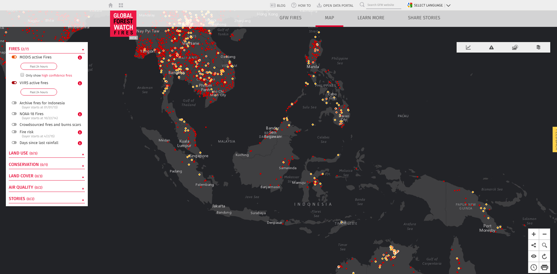
Satellite-based fire detection data have emerged as a powerful tool to combat these outbreaks. These data are used in Indonesia by government agencies, companies managing land for wood fiber and palm oil production, protected area managers and civil society organizations to track and prevent fires. Though useful, the data aren’t perfect and can often be too coarse to detect smaller fires or cover too large an area for responders to find evidence of the flames on the ground. Fire alerts based on NASA’s MODIS satellite detect fires at 1km resolution—the size of 140 soccer fields. But now Global Forest Watch will feature new data that detect fires around the world in greater detail and accuracy than ever before.
Called VIIRS active fires, the new product is able to map fires at 375m resolution, which will make a significant difference in locating fires within the peatlands and forests of Indonesia and around the world. The data are now available on Global Forest Watch Fires, which focuses on Southeast Asia, as well as the main Global Forest Watch platform.
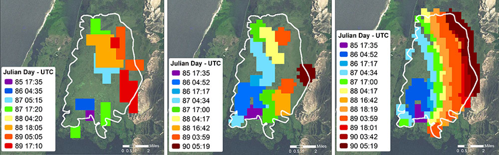 A fire spreading in the Taim Ecological Reserve in southern Brazil mapped by 1km Aqua/MODIS (left), 750m VIIRS (center) and 375m VIIRS (right) from March 26-31, 2013 (Julian Days 85-90). Source: “The New VIIRS 375 m active fire detection data product: Algorithm description and initial assessment.”
GFW plans to continue working with field-based managers to test VIIRS fire data for operational fire response. We strive to help land managers better access and use these novel technologies to improve capabilities for rapid fire response as well as enable researchers developing these tools to benefit from land managers on the front line of fires response.
| COMPARISON OF MODIS AND VIIRS FIRE ALERTS | ||||
|---|---|---|---|---|
| MODIS | VIIRS | |||
| Satellite | MODIS Terra and Aqua | Suomi NPP | ||
| Resolution | 1km | 375m | ||
| Year Started | 2000 | 2012 | ||
| Frequency | 4 times daily (2 satellites) | 2 times daily | ||
| Minimum fire size detected | 1,000 m2 (smaller in ideal conditions) | As small as 5m2 for fires with temperature >1,000K; larger minimum size for detection of cooler fires | ||
| False positives | Global 1.2%; higher rate for Equatorial Asia (< 8%); varies by region | Global | ||
| Latency (time after satellite overpass when data are available) | 30 minutes to 2 hours after satellite observation | 30 minutes to 2 hours after satellite observation | ||