Global Forest Watch Has Updated Political Boundaries — Here’s What You Should Know
Global Forest Watch (GFW) is constantly being updated to reflect the most recent and accurate data related to forests. To that end, we’ve updated the political boundaries available on GFW to the most recent version from the Database of Global Administrative Areas (GADM), an open-source political boundary data set. This update ensures that the map, statistics and analyses on GFW use the latest and most accurate information.
With this update, you may observe some changes that are important to be aware of, including changes to the names of political areas; the boundaries for countries, regions and subregions; map functionality around disputed areas; information in forest change and fire alert emails; and data set statistics.
This blog will walk through each of these changes — read on to learn more.
What is changing and who do these changes affect?
For many years, GFW has used GADM boundaries as political boundaries for analyses of geospatial data hosted on GFW. When a user performs an analysis of a political boundary on the map or views statistics for a country on the dashboards, they are seeing statistics for a GADM boundary.
In this recent update, we moved from GADM version 3.6 to version 4.1 to provide newer and more accurate information, including renamed areas, adjustments to political borders and more.
Please note, however, that there are various sources of political boundaries available. You can view instructions in our Help Center on how to upload shapefiles of an alternative country, region or subregion’s boundary.
At the time of this article’s publication, this change is only relevant to the main GFW site, map and dashboards. GFW Pro will also update its political boundaries soon.
Which areas are affected by this update?
This update includes changes in boundaries across the globe at different levels. GADM labels these different levels as “administrative units,” and breaks them down as follows: “admin 0” refers to country level, “admin 1” refers to state/province level, and “admin 2” refers to county/district level.
Country boundaries
There is no official changelog available from GADM for this update, but our team has identified several changes to country boundaries. We saw small but noticeable differences in the borders of approximately 10 countries: Chile, China, Colombia, Costa Rica, Djibouti, Saudi Arabia, Somalia, Togo and Uruguay.
Subnational boundaries
Our analysis also revealed several updated subnational boundaries.
Multiple countries added or removed regions (admin 2 areas):
| Countries | Number of regions in GADM 3.6 | Number of regions in GADM 4.1 | Change |
| Colombia | 1065 | 1119 | +54 |
| Togo | 21 | 40 | +19 |
| Djibouti | 11 | 21 | +10 |
| Brunei | 32 | 39 | +7 |
| American Samoa | 16 | 17 | +1 |
| Benin | 76 | 77 | +1 |
| Chile | 54 | 55 | +1 |
| Costa Rica | 81 | 82 | +1 |
| Australia | 569 | 568 | -1 |
| Kenya | 301 | 300 | -1 |
| Ukraine | 629 | 628 | -1 |
| Yemen | 333 | 332 | -1 |
| Macao | 8 | 2 | -6 |
| Uruguay | 204 | 141 | -63 |
| Netherlands | 491 | 355 | -136 |
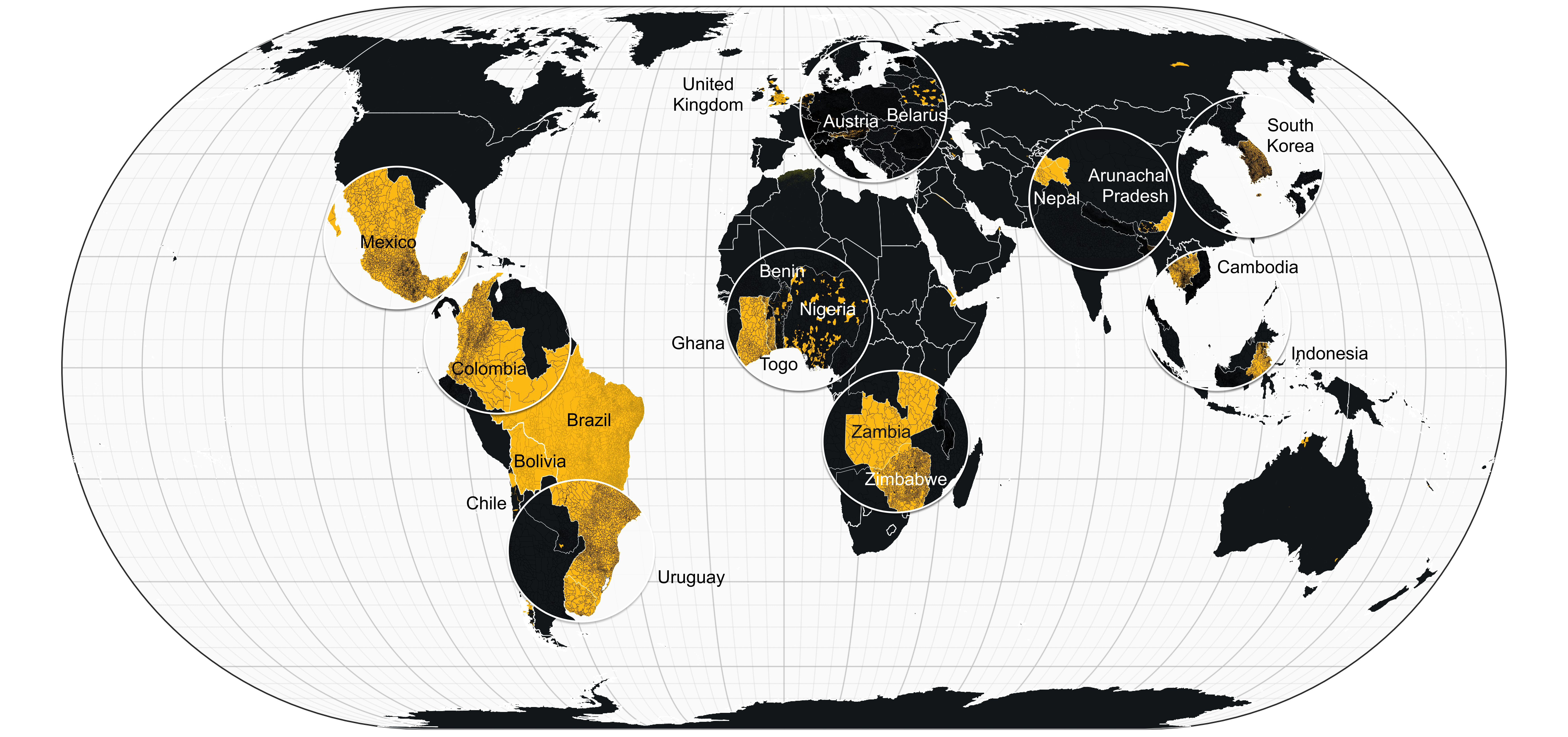
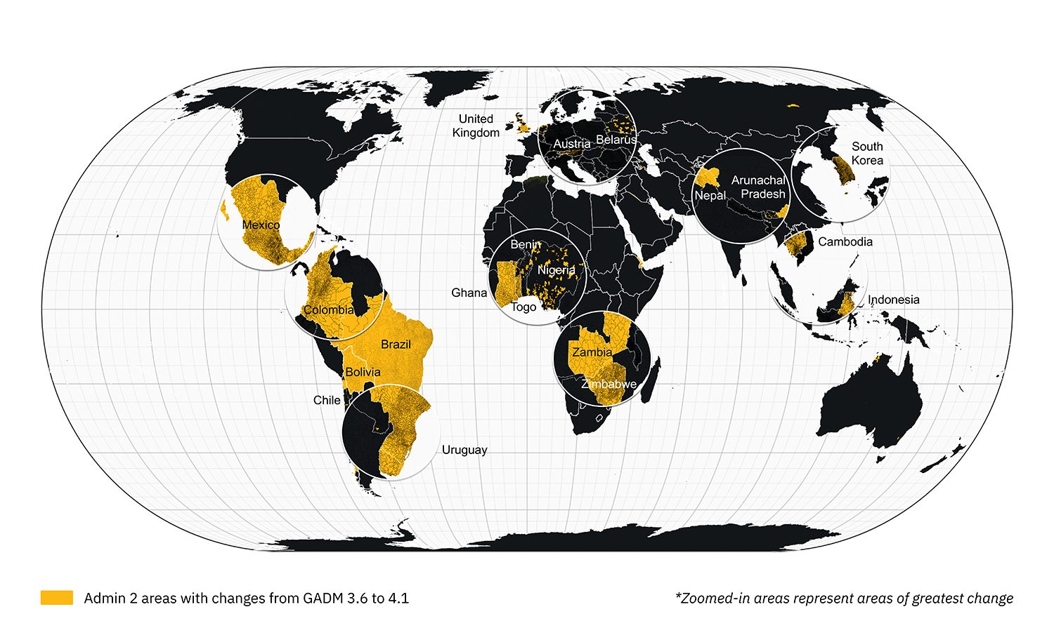
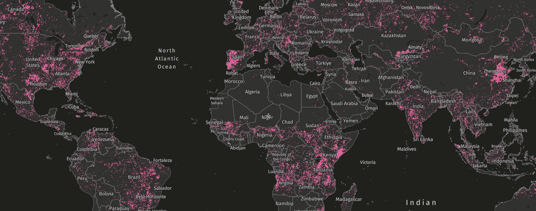
At the subnational level, we noted some changes in names, identification codes and/or borders, especially in West and Southern Africa, Central America, South America, Europe and Southeast Asia. The yellow areas of the map below show the updated admin 2 areas that were changed:
Disputed boundaries
One major change in this update is that some politically disputed boundaries are no longer included in any country or subnational analysis (note that GADM does not include all disputed boundaries in their data).
With this update, disputed areas are only included in global analysis available on the dashboards. This is because the previous GADM version (3.6) did not delineate disputed boundaries, but GADM 4.1 does: in version 4.1, disputed areas are separated from adjacent admin areas and have their own identification codes. This will mean that the GFW country analyses will no longer include any areas GADM identifies as politically disputed.
For example, the disputed region of Kashmir between China, Pakistan and India is now delineated in version 4.1.
How will this update affect GFW data and statistics?
Analyses
With this update, any changes in area boundaries will result in some changes to statistics and results of analyses. If you’d like to compare the previous and new version of your admin area, we recommend downloading the 3.6 version for the chosen area via the GADM site and comparing it to the same area on the GFW map or dashboard. Please see this article in our Help Center for instructions on how to upload shapefiles.
As an example of this type of change, there are now five provinces in Kalimantan, Indonesia instead of four: Kalimantan Timur (East Kalimantan) has split into two areas — Kalimantan Timur and Kalimantan Utara (North Kalimantan).
Alert subscriptions and areas saved to MyGFW accounts
Users will no longer receive alert subscription emails for countries, regions or subregions saved to their MyGFW account before April 29, 2025.
To make this change more convenient, we automatically updated political boundaries for saved countries, regions and subregions that maintained the same name between GADM versions 3.6 and 4.1. Users whose areas were automatically updated will receive an email notifying them of this change.
However, if you did not receive an email from us or have multiple saved political boundaries, we recommend that you re-save relevant areas of interest to your MyGFW account:
- Navigate to your MyGFW account and look for areas marked with an “outdated area, notifications paused” tag.
- Once you have noted the country, region or subregion that is no longer receiving alert emails, navigate to www.globalforestwatch.org/map.
- Search for the area or navigate to it.
- Click on the area, select “analyze,” and then select “save in MyGFW.”
- Customize the saved area by selecting a name, tags, alert notifications and more, and then click “save.”
You will then continue to receive alert notification emails for this area.
Embeds and URLs
Embeds of and links to countries, regions and subregions on the dashboard and map may now show or link to new areas. This is due to the GADM identification code changing between versions.
If you are using an embed that shows a political boundary, we recommend checking that it still shows the area you originally chose; if the area’s identifier changed, the embed may show an entirely new area.
Example from Ghana where the embed shows a new area due to the area identifier changing
If you saved a URL that links to a political boundary, we also recommend checking that the URL still shows the desired area of interest. If it does not, follow these instructions on how you can search for an area on the map and dashboards.
Where can I ask questions and get help?
The GFW team aims to provide the latest forest monitoring updates for users and support your use of the GFW platform, and we highly value your feedback. If you have feedback on these changes or need help, please contact us at gfw@wri.org.
Explore More Articles
Looking for the Quickest Signal of Deforestation or Vegetation Disturbance Globally? Turn to GFW’s Integrated Disturbance Alerts
GFW’s integrated alerts layer combines the power of four alert systems for an improved view of deforestation and other vegetation disturbances globally.


