Behind the Pixels: Monitoring Deforestation in Post-Coup Myanmar
Armed conflicts worldwide occur disproportionately in tropical forested regions. Countries in the World Bank’s Fragile and Conflict-Affected Situations list contain substantial tropical forest cover, and forests have long served as theaters for political violence in rural areas. This overlap creates a difficult dilemma for forest conservation: The places where forests face the greatest pressures — from both conflict-driven resource extraction and communities displaced by violence — are often the most dangerous and challenging to monitor. Traditional forest monitoring relies on regular field patrols to document illegal activities, but in conflict zones, sending patrol units into contested territory can mean risking their lives.
In Myanmar, the 2021 military coup triggered devastating consequences that continue to intensify. Thousands of civilians have been killed by the military and several million displaced by fighting — with 2024 recorded as the worst year thus far. Against this backdrop of political violence and instability, we confronted a critical question: How can forest monitors work safely and effectively in active conflict zones?
From June 2024 to April 2025, two researchers with Forest Trends (the authors of this blog) partnered with Myanmar’s National Unity Government (NUG) Ministry of Natural Resources and Environmental Conservation (MONREC) to monitor over one million hectares of protected forests across five townships in Sagaing and Magway regions. Using Global Forest Watch (GFW) tools, we trained 15 NUG MONREC forest officers to detect deforestation alerts from satellite imagery, prioritize which sites to investigate, and conduct ground-truthing only where security permitted.
What we learned offers insights not just about Myanmar’s forests since the coup, but about the role of remote sensing in armed conflict zones more broadly.
Forests in Conflict: Shelter and Spoils
Armed conflict and forests are deeply interconnected, though this relationship is far from straightforward. Research has shown that armed conflict can lead to both more intensive or less intensive land use, creating seemingly contradictory deforestation patterns. This is because armed conflict itself is rarely a direct driver of deforestation. Instead, conflict primarily affects other mechanisms that underlie land-use decisions — such as displacement of populations, disruption of governance, changes in resource access or conflict financing through resource extraction—which explains the diverse forest loss outcomes observed in conflict zones. Despite upwards of half of tropical forests worldwide located in countries with active violent conflict, few conservation efforts adequately account for how armed conflict shapes forest dynamics.
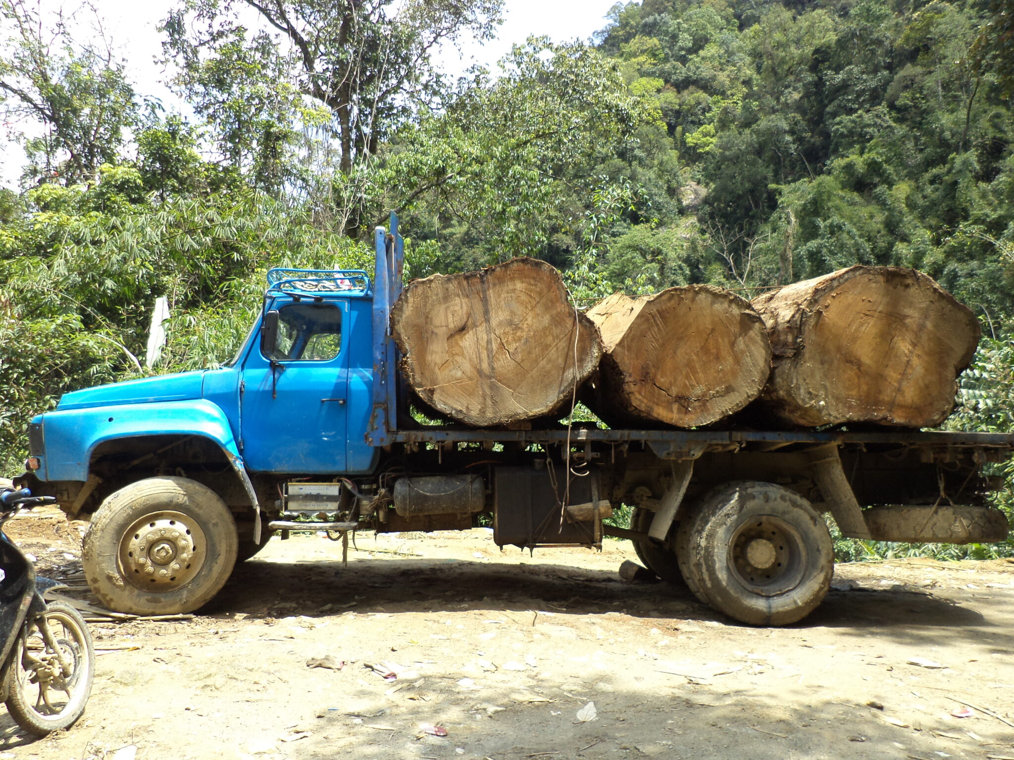
In Myanmar, forests play a complex dual role in the ongoing civil war. On one hand, they provide shelter for the millions displaced by violence — communities fleeing military airstrikes and ground offensives often establish makeshift settlements in forested borderlands. On the other hand, forests serve as both battlegrounds and sources of revenue. Armed groups across Myanmar’s ethnic territories, whether resistance forces or junta-aligned militias, have historically financed operations through timber extraction and agricultural concessions. Since the coup, the military junta has intensified natural resource exploitation to fund its war machine as the broader economy collapses, while resistance groups similarly rely on natural resources, including timber and forests, to sustain their operations.
This dynamic creates what our project sought to address: How do you monitor forests when the people who need to do the monitoring cannot safely access the land? Remote sensing emerges as a critical tool not just for conservation, but for governance, accountability and documentation in conflict zones. Beyond tracking deforestation, satellite monitoring can serve diverse actors: civil society organizations documenting environmental destruction, territorial networks and Indigenous groups demarcating their lands and resources, opposition governments like the NUG maintaining governance functions despite lacking traditional state infrastructure, international watchdogs tracking illegal resource extraction and funders assessing impacts of their investments. Critically, remote sensing can also help document war crimes and violations of international sanctions — such as illegal timber exports by the sanctioned MTE or environmental destruction in contested territories — providing evidence that would otherwise be impossible to gather safely on the ground.
In our monitoring work, we found that conflict shaped not just whether forests were lost or conserved, but where and how. Protected areas in territories contested between the junta and resistance forces became paradoxically both harder to exploit (due to fighting) and more vulnerable (due to weakened governance). Understanding these patterns required us to think beyond traditional conservation monitoring and consider remote sensing paired with conflict-sensitive ground-truthing as the main tools for maintaining environmental governance when the state itself is fractured by civil war.
Building Capacity in Crisis
Working with the NUG government-in-exile operating in contested territory meant rethinking assumptions about forest monitoring. Unlike typical forest management where staff travel from provincial offices to field sites within secure territory, our team navigated a patchwork of shifting conflict territories: Office-based manager teams worked from various locations in Myanmar conducting remote satellite analysis, while field monitoring officers carefully operated inside loosely-controlled NUG territory conducting ground-truthing investigations based on alerts prioritized by the remote teams. NUG MONREC staff could not simply drive to a deforestation site; each field visit first required security assessments, local intelligence gathering and careful route planning to avoid military checkpoints and junta-aligned PDF units. Some areas remained completely off-limits throughout the project.
We started with comprehensive trainings in August 2024, using GFW’s tools such as AOI dashboard and Forest Watcher. We added Burmese subtitles to GFW training videos — a seemingly small detail that proved essential for long-term sustainability, and which can now be accessed on NUG MONREC’s website. Forest Watcher’s offline functionality proved essential as most field areas lacked internet connectivity. Forest Watcher’s Burmese script capability meant field monitoring officers could report their findings directly in Burmese, which reduced errors and miscommunication between office-based manager teams and field officers who have limited English proficiency. This ensured the monitoring system’s sustainability beyond external project support, as the tools became genuinely accessible to local teams who would continue this work after our project ended. When we identified a display bug affecting Burmese characters early in the project, GFW’s technical support team quickly investigated and resolved it — a fix that potentially benefited other character-based languages as well.
This system proved effective despite the challenging context. The structure worked as follows: One field monitoring officer team per township, two office-based managers coordinating operations and monthly online meetings to prioritize which alerts warranted the risk of field investigation. This allowed systematic monitoring even as conflict escalated in the areas being monitored.
The People Behind the Pixels
The power of satellite monitoring lies not in replacing ground-truthing, but in guiding it strategically — especially when field access can be potentially insecure or impossible. From June 2024 through April 2025, our office-based manager teams detected 55,340 deforestation alerts across 1.04 million hectares under surveillance. But in a conflict zone, the question isn’t just “where is forest being lost?” but “where can we safely investigate?”
The team prioritized 209 alerts for ground-truthing based on three criteria: location in government-designated protected forest areas, acceptable security conditions for field visits and clustering of multiple alerts in the same area. These 209 investigations covered 629 hectares in protected forests in Sagaing and Magwe regions and revealed patterns that satellite imagery alone could never fully explain — but which the imagery had successfully guided us to unearth.
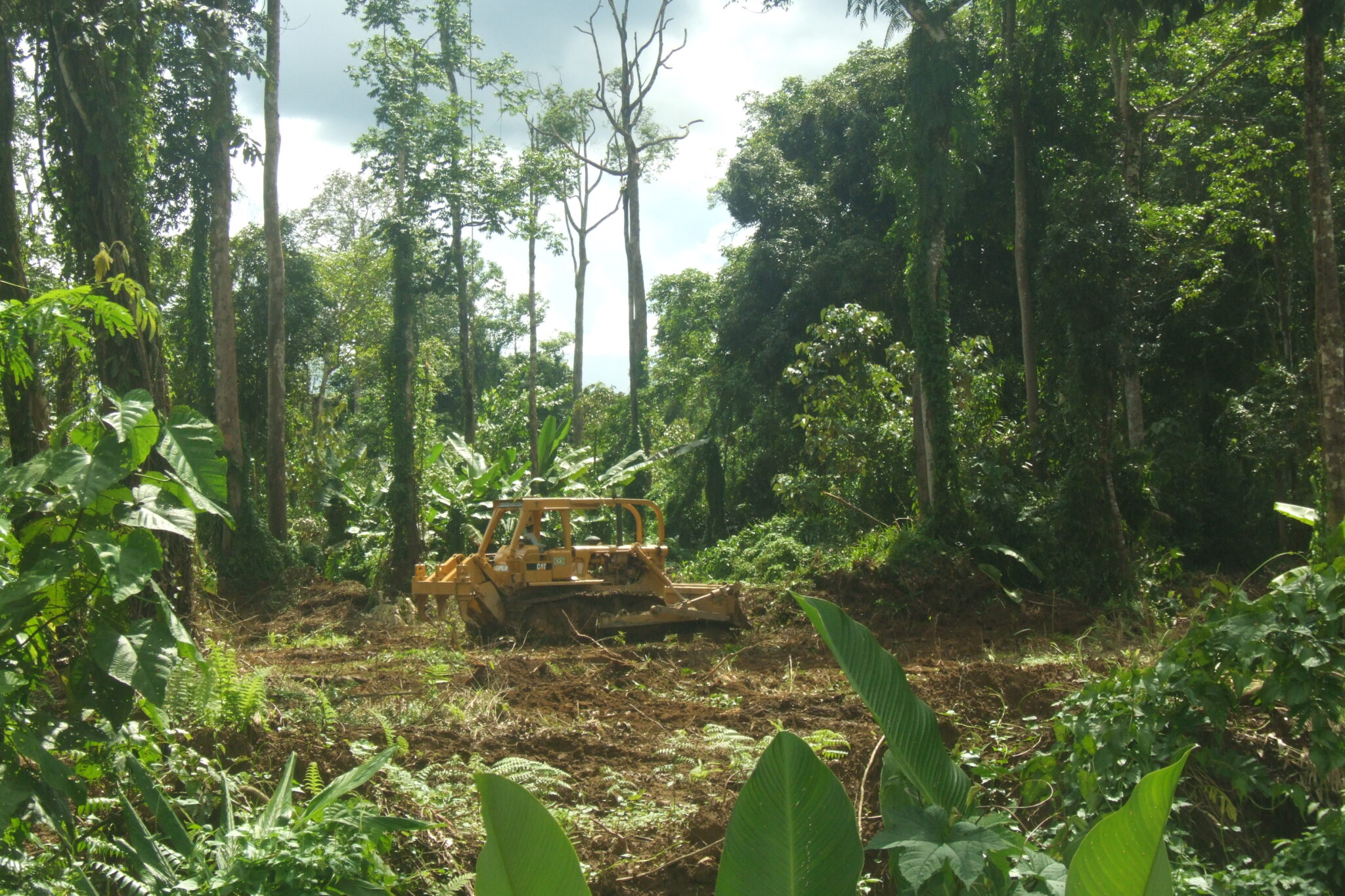
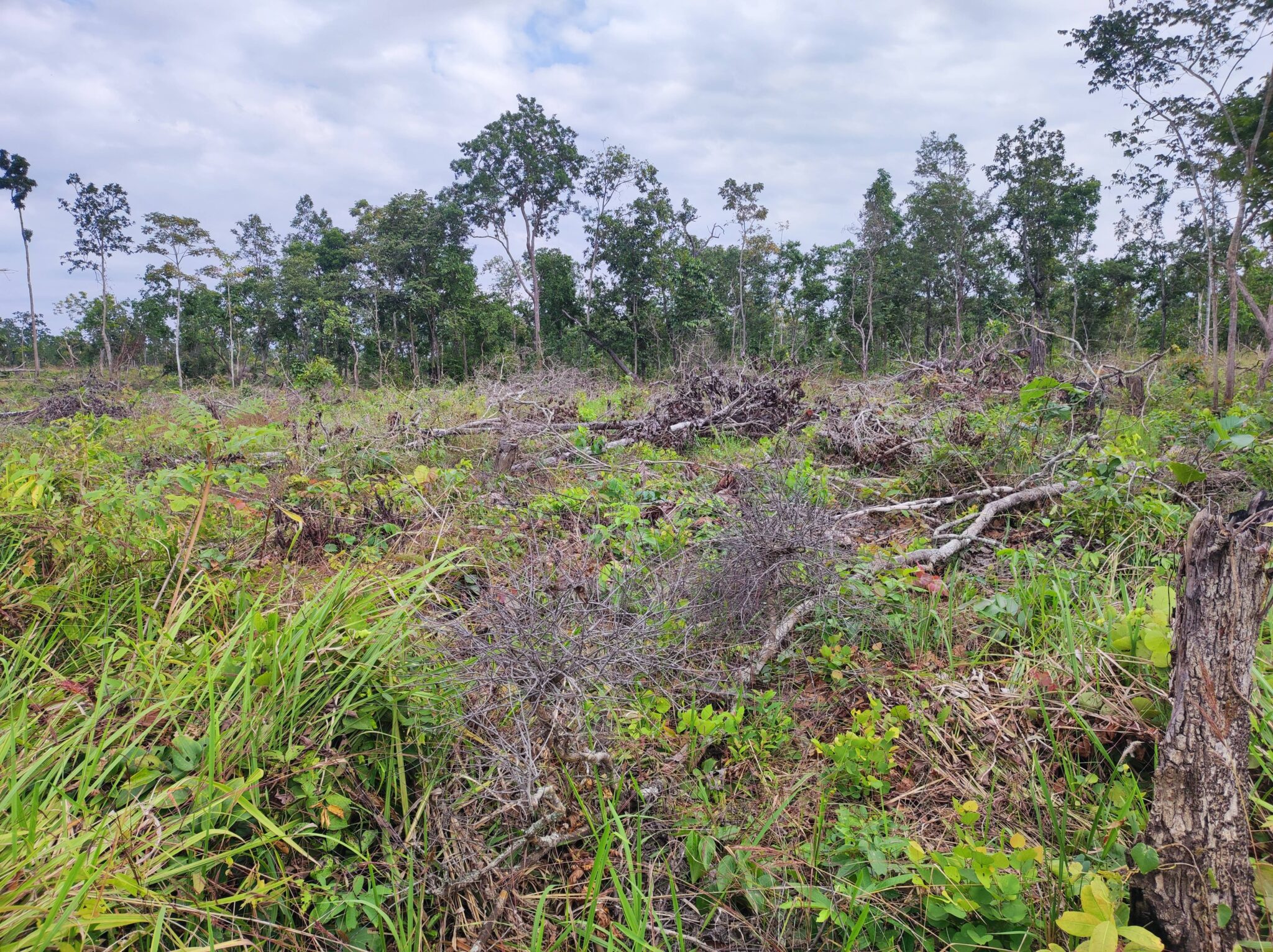
What field officers found was more complex than simple categories of “legal” or “illegal” deforestation. Ground-truthing revealed 143 of the 209 alerts (68 %) as the recent expansion of smallholder subsistence agriculture — particularly in Magway Region. Field teams discovered most of these agricultural sites did not involve clearing intact forest. Instead, families displaced from fighting were cultivating areas already disturbed by previous commercial logging activities. These were not criminals capitalizing on crisis, but humanitarian cases — displaced families who had lost everything to military violence seeking survival in forest reserves.
In contrast, field monitoring teams also found evidence of resource extraction that was causing new deforestation. Mining operations — primarily small-scale gold extraction led by local entrepreneurs looking for quick profit — accounted for approximately 30% of verified deforestation, concentrated heavily in Sagaing Region’s Banmauk township (49 cases). This finding surprised us as we had expected commercial logging to be the dominant driver. Yet only one logging case — carried out by locals but presumably backed by an armed militia — was documented among the 209 investigations. The remaining cases were three charcoal production sites.
The satellite data had successfully pinpointed where land use change was occurring, but only ground investigations could reveal the human stories and specific drivers behind each pixel of forest loss. Some clearings represented desperate families in a humanitarian crisis. Others pointed to local entrepreneurs exploiting the chaos of civil war to extract minerals from protected forests. The distinction matters enormously for determining appropriate responses — whether humanitarian assistance, enforcement action or conflict resolution.
An Unexpected Driver Emerges
Our initial expectation was straightforward: Weakened governance plus desperate communities fleeing fighting would mean a surge in illegal logging. The data told a different story.
Of the 209 alerts we investigated, mining emerged as the largest source of ground-verified new deforestation at approximately 30% of alerts. This finding was particularly striking when compared to commercial logging, which accounted for only one documented case.
The concentration of mining in Sagaing Region was unmistakable: In particular, Banmauk township (49 cases) but also Katha (8 cases) and Inndaw (6 cases) townships showed locally-orchestrated gold extraction operations. For the first time in this pilot region, geo-referenced field-verified data confirmed what had been anecdotal reports: Mining operations have rapidly proliferated since the coup. As Myanmar’s economy destabilized, enterprising villagers turned to gold extraction as a more stable and valuable commodity that’s also easier to smuggle.
This discovery shifted both our understanding of what was driving forest loss and what response was needed. Mining’s environmental footprint extends far beyond tree cover loss: mercury contamination of waterways, soil degradation and long-term ecosystem damage create impacts that are far more difficult to reverse than selective logging. Remote sensing did not just document the problem — it catalyzed action in real-time, even during political crisis.
The finding triggered immediate institutional response: NUG MONREC conducted a comprehensive training series on mining and its environmental and health impacts (including mercury contamination), initiated new coordination between MONREC and other ministries overseeing mining regulation and law enforcement and pushed for a fundamental shift in how forest threats are understood and addressed.
Practical Lessons for Conflict Settings
Operating in Myanmar taught us that remote sensing in conflict zones requires constant adaptation. Technical challenges, weather disruptions, and infrastructure limitations demanded creative problem-solving from field teams.
When GFW’s base maps lacked village names and road networks in remote areas, teams geo-referenced alert locations on Google Earth. In the second phase of monitoring, a technical limitation emerged: Newly updated alerts would disappear from the app when teams switched to offline mode unless they were downloaded first. To address this, field monitoring officers developed a systematic workflow: After the office manager team assigned prioritized alerts, monitor teams downloaded the alerts while still online, then cross-referenced the coordinates with Google Maps to identify village names and waterways, since GFW’s base map lacked these details. Only after capturing this location information — sometimes through screenshots of coordinates — would monitoring teams switch to offline mode and deploy to the field.
When monsoon rains, remote rural locations and military operations disrupted internet connectivity, this pre-deployment preparation became critical, requiring teams to pre-download imagery and complete all online coordination before heading into areas where connectivity would be unavailable.
These workarounds required flexibility and ingenuity. For practitioners working in similar contexts, here is what we learned:
The ability to surveil forests from satellites meant teams could maintain awareness across the study area while limiting dangerous field exposure. We investigated less than 1% of alerts, but this selective approach was not a failure — it was a strategic prioritization that kept field teams safe while still gathering actionable intelligence. Each investigation required careful security assessments; teams only proceeded when risks were deemed acceptable based on local intelligence about military presence and conflict activity.
Tools that cannot be adapted to local contexts will not be sustained when external projects end. Language support is critical for sustainability and effectiveness. Burmese subtitles on training materials increased knowledge transfer and retention among staff. Forest Watcher’s Burmese language capability — enabled through collaborative bug-fixing with GFW engineers — allowed field officers to report findings in their native language, reducing errors and improving communication with office-based teams. But localization goes beyond translation: it includes adapting workflows to match local institutional structures, ensuring training materials account for varying technical literacy, building capacity within local organizations to maintain and troubleshoot systems independently, and designing protocols that reflect on-the-ground realities rather than imposing external assumptions.
Conflict zones often have disrupted connectivity and infrastructure. Practitioners should design protocols assuming limited internet access, test offline functionality thoroughly before field deployment and develop backup systems for when primary tools fail. In Myanmar’s case, this meant ensuring critical information could be captured via screenshots, coordinating pre-field planning during periods of connectivity and maintaining flexibility when technology didn’t work as expected.
Ground-truthing revealed that identical satellite alerts represented completely different situations — displaced families clearing land for survival versus illegal mining operations require fundamentally different responses. Remote sensing provides the “where”; field verification combined with local knowledge provides the “who” and “why” that inform appropriate action.
Moving Forward
Environmental governance in conflict zones is often treated as impossible, something to address only after peace arrives. Our experience suggests the opposite: Forest monitoring during political crisis is both feasible and essential. It builds institutional capacity that will outlast the conflict, generates evidence that can inform post-crisis forest management and restoration and demonstrates environmental accountability when governance legitimacy is contested.
Remote sensing in conflict settings holds value for diverse actors beyond traditional forest agencies. Civil society organizations and territorial networks can use satellite monitoring to document and defend community land rights and resources. Opposition governments like the NUG can maintain oversight and demonstrate governance capacity even with limited territorial control. International watchdogs can track illegal resource extraction that fuels armed conflict. Funders can verify that conservation investments continue protecting forests despite instability. And crucially, satellite monitoring can document violations that extend beyond environmental harm — including potential war crimes and sanction violations tied to natural resource exploitation.
For practitioners considering similar work, our recommendation is clear: Do not wait for stability. Equip various local institutions with satellite monitoring tools, invest in their capacity, trust their judgment and support security risk assessments, and design flexible systems that acknowledge the humanitarian dimensions of forest pressure.
A critical caveat: What proved feasible in Myanmar’s specific context — including security conditions, connectivity infrastructure and institutional capacity — may not translate directly to other conflict settings. Each context requires careful security risk assessment before proceeding with field monitoring. Practitioners should assess local conditions thoroughly and proceed with field verification only when deemed safe. For additional guidance on conducting forest monitoring in high-risk areas, see resources like the ALLIED network’s practitioner guidance.
Remote sensing will not eliminate the dangers of working in conflict zones, but it can help forest monitors make smarter decisions about when the risk of field investigation is justified and when it is better to keep watching from above.
Protecting forests during political crisis is not just about trees. It is about maintaining livelihoods, demonstrating accountability and building the institutional legitimacy that supports peacebuilding itself. Environmental governance need not wait for peace. It can be an integral part of building it.
Kevin Woods is currently serving as Fellow, East-West Center, Honolulu, HI, USA; and Research Associate, Chulalongkorn University’s Faculty of Political Science, Bangkok, Thailand.
Nyein Chan is currently affiliated with the Department of Environmental and Bioresource Sciences, Faculty of Bioenvironmental Sciences, Kyoto University of Advanced Science (Kameoka campus), Kyoto JAPAN.