Mapping Forest Roads in the Congo Basin in Unprecedented Detail with AI
In Congo Basin forests, a new road can cause big changes. What may start as a single narrow path can start a cascade of disturbances by opening up access to intact forest, making it vulnerable to agricultural expansion, mining, logging, poaching and other threats. Tracking these roads is an important step in reducing their impact on forests, yet these roads — often unpaved, temporary and quickly overgrown — can be difficult to detect.
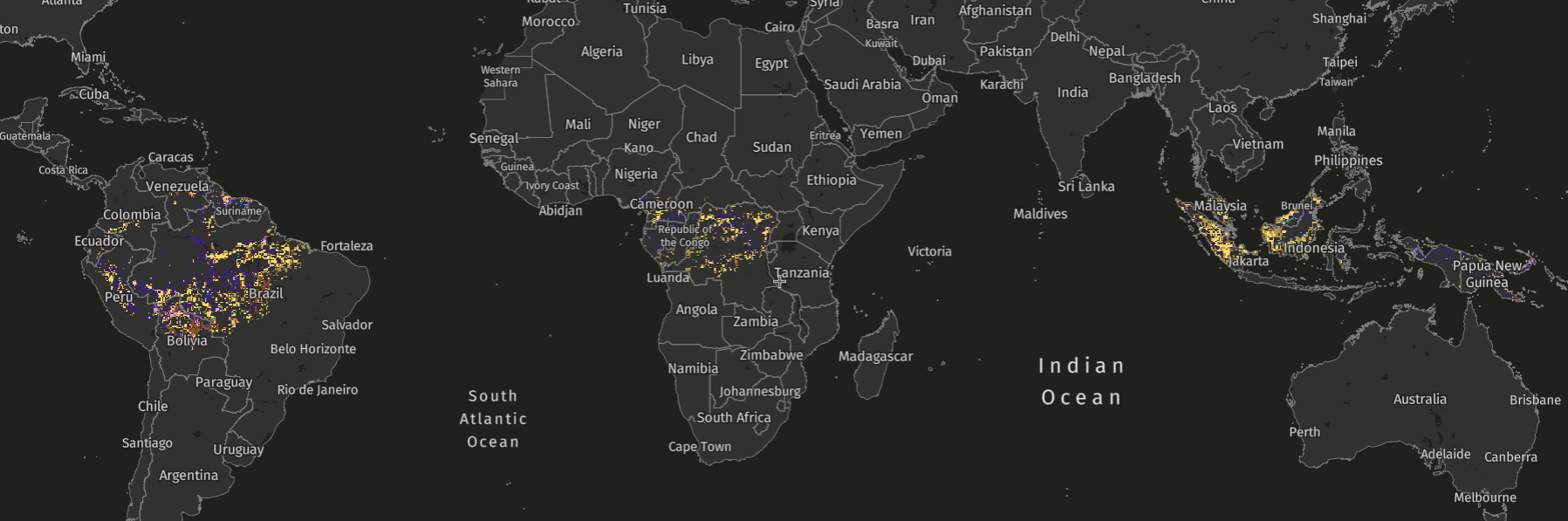
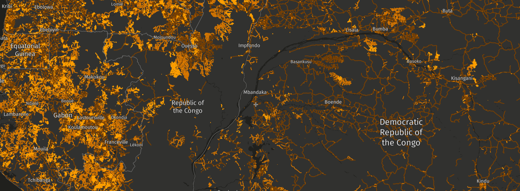
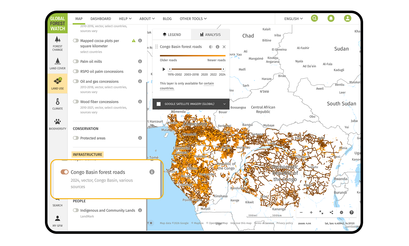
A new, high-resolution data set on Global Forest Watch (GFW) helps to close this gap by providing the most comprehensive view to date of forest road development in the Congo Basin. This updated data set builds on recent research that uses satellite imagery and AI to map forest roads in unprecedented detail, identifying roads first detected from 2019 onward and integrating them with a historical archive of road data extending from 2018 back to 1976. Together, this offers decades of insight into how roads have expanded across one of the world’s most vital tropical forest regions.
This release comes at a critical moment. Road expansion, particularly associated with selective logging, can lead to serious forest degradation by fragmenting habitats, increasing carbon emissions and opening previously intact areas to further clearing. Data tracking road development can support verification of logging legality, as well as monitor mining encroachment and agricultural expansion.
In the Congo Basin, there is strong and growing demand for this type of data from government ministries, civil society organizations and forest monitoring initiatives. With technological developments such as this AI-powered approach, we are able to automatically track in high detail where and when road networks expand, meeting demands for valuable information needed by those who monitor forest change in near-real-time.
Why do forest roads matter?
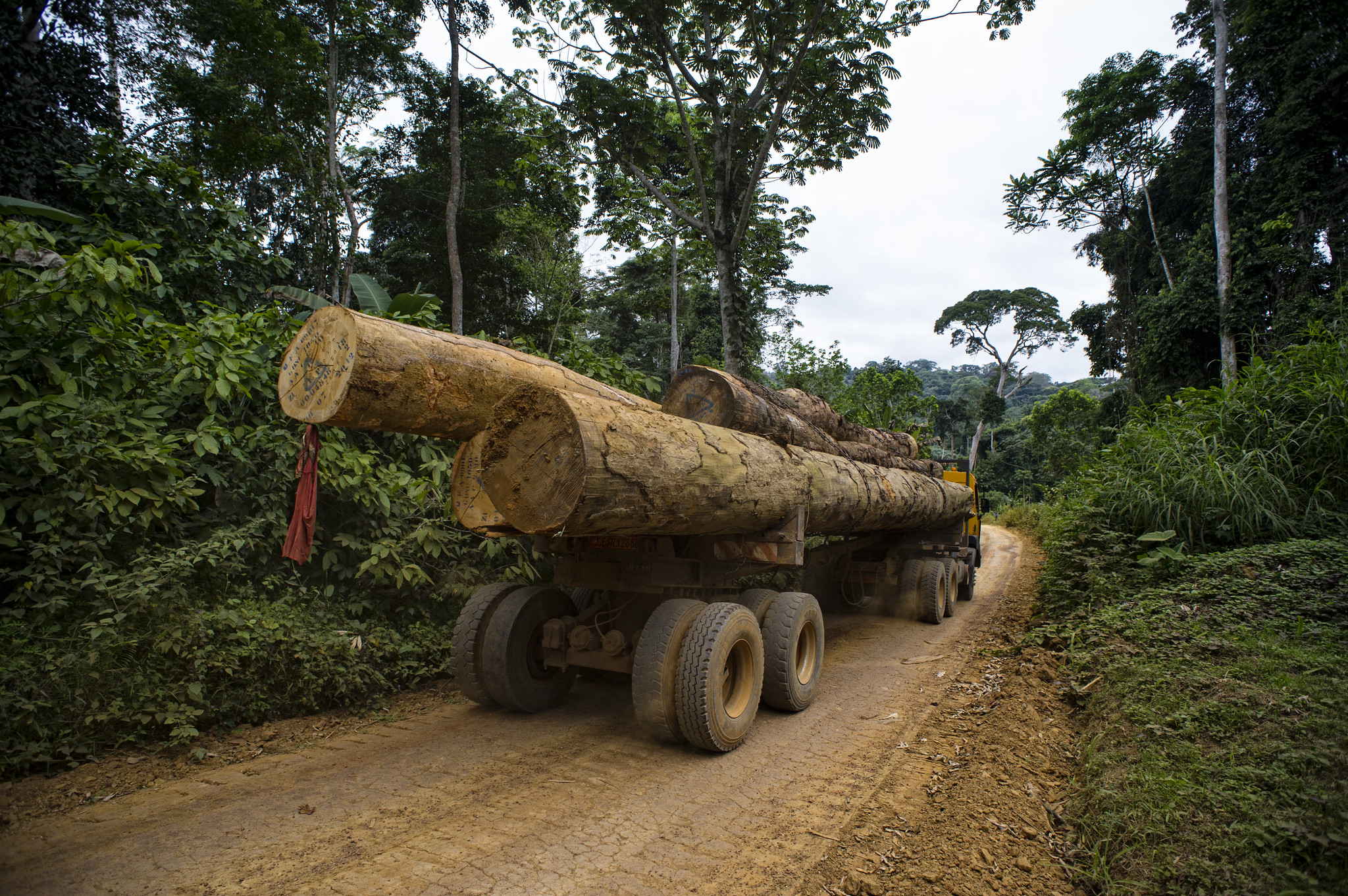
Forest roads are often the first physical footprint of industrial activity in tropical forests. Most of the roads in the Congo Basin are unpaved, and only temporarily used for selective logging, which entails harvesting valuable and mature trees while leaving the majority of the forest intact. While forest products benefit regional economies, some extractive practices are more detrimental than others. In tropical forests, selective logging can be part of a sustainable management regime if done with care, compared to clear cutting and establishing timber plantations.
However, the impact of logging roads can be long-lasting. Clearing forest corridors for road construction is the largest source of carbon emissions associated with selective logging in Congo Basin countries, and also contributes to habitat fragmentation, soil disturbance, edge effects and increased fire risk.
The impacts of logging roads often extend well beyond the initial harvest. When roads remain accessible after logging, they can leave remote forests vulnerable to unauthorized activities such as agricultural expansion, mining, hunting and unregulated logging. In recent decades, road networks have increasingly expanded into intact forest landscapes, which are identified as having little or no prior human influence. The latest data indicates that almost a quarter of Congo Basin forest roads are located in forests that were mapped as intact as of 2016.
What does the new Congo Basin forest roads data show?
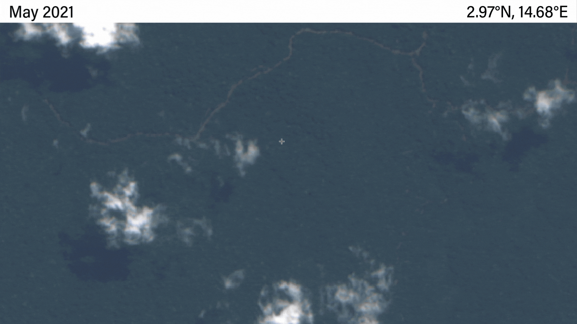
Monitoring forest roads is important but challenging. Without knowing where these roads are and how they’re changing over time, it’s impossible to assess their impacts or know what actions need to be taken. Many logging roads are narrow and vegetation grows back quickly after harvest, making them difficult or impossible to detect without the use of radar and optical satellite imagery. Especially in the densely cloud-covered Congo Basin, transient roads going unnoticed pose a major risk.
The new forest roads data set provides highly detailed mapping of road development in tropical rainforests across six Congo Basin countries: Cameroon, Central African Republic, the Democratic Republic of the Congo, Equatorial Guinea, Gabon and Republic of Congo.
Key features include:
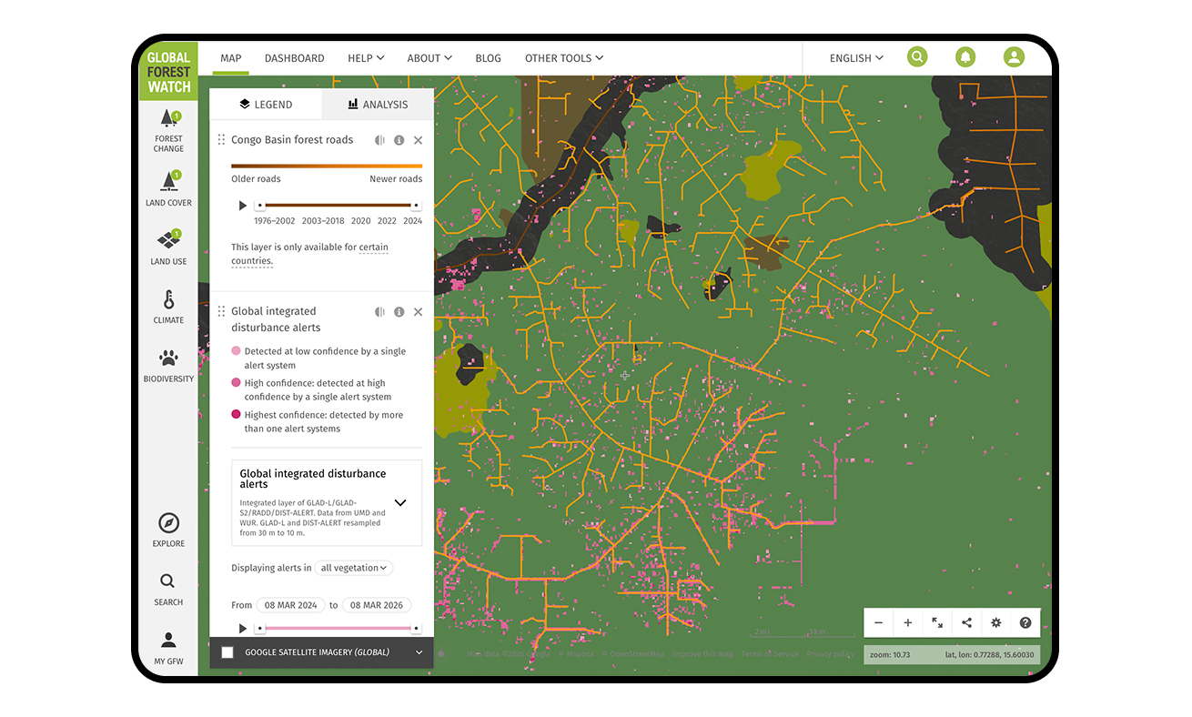
- Updated road detection from 2019 onward, using AI and both optical and radar-based satellite imagery to map transient forest roads that often go undetected in conventional road data sets, with roads attributed by detection year and viewable by time range on GFW.
- A long-term historical archive, combining the new data with earlier road maps created from satellite imagery going from 2018 back to 1976.
- Improved coverage and consistency, offering users a single, integrated data set rather than multiple sources.
Prior to this change, GFW hosted a Congo Basin logging roads data set that was last updated in 2014. That data set was produced through a crowdsourcing effort from the Logging Roads initiative led by Moabi, GFW and the European Commission’s Joint Research Centre. Volunteers used satellite imagery and OpenStreetMap-based tools to manually trace roads and estimate when they appeared. While groundbreaking at the time, the data set covered a limited time period and was difficult to update.
In subsequent years, researchers manually updated the data set through 2018 and integrated it with an earlier road inventory that had digitized roads from more than 300 Landsat images collected between 1976 and 2003, creating a comprehensive archive of roads data.
The new data combines the hand-digitized data with a new AI-based approach to offer a more complete and current picture of forest road expansion across the region.
Users can view the Congo Basin forest roads data on the GFW map by selecting the Congo Basin forest roads layer in the Land Use data sets section under Infrastructure.
Additionally, the data will be integrated into national Forest Atlases, which combine government information with independent monitoring tools to support transparent forest management.
How was the data created?
We mapped roads from 2019 onward using an advanced deep learning model developed by Wageningen University & Research, based on both Sentinel-1 and Sentinel-2 satellite imagery. The imagery uses radar sensors that can “see through” clouds, which allows for road detections even during the Congo Basin’s frequent rainy seasons. The automated algorithm processed thousands of satellite images and was designed to be continuously updated.
To extend the data set further back in time, the new road data was merged with historical maps that include the manually digitized roads from Landsat imagery covering 1976–2003 and crowdsourced mapping efforts. While detection methods differ, together they provide a valuable long-term archive of forest access and fragmentation.
As with most large-scale data sets, there are important caveats that users should be aware of:
- Not all forest roads are associated with selective logging, although many mapped roads are linked to logging activities. The logging concessions layer on the GFW map can provide further context.
- The data set does not indicate the legality of roads or associated activities.
- Road widths are not shown to scale, and the data does not show whether a road is still in use (for example, some roads may have overgrown since they were detected).
- Additionally, overlap between older and newer roads may indicate the reopening of older roads. This may be of interest to users investigating selective logging activities because a road reopening can indicate that a new harvest cycle has started at a location where old, overgrown logging roads are being reopened and reused (which generally has less environmental impact than constructing entirely new ones). However, note that reopened roads may not perfectly align with new roads on the map, since new roads (2019 onward) were mapped with more spatial precision than old roads.
How can the data be used?
The updated forest roads data set supports a wide range of applications:
- Forest monitoring and law enforcement: Users can track where new roads appear inside or outside logging concessions, helping to flag potential illegal activity and support patrol planning.
- Concession oversight: Governments and civil society organizations can assess whether road development aligns with approved logging plans and schedules. Detailed logging road maps can also be used to evaluate and potentially reduce the impact of selective logging activities.
- Research and analysis: Researchers can use the long-term archive to study logging trends, infrastructure persistence and the carbon implications of new versus reopened roads, as well as the relationship between roads, degradation and deforestation.
- Conservation and land-use planning: By revealing patterns of access and fragmentation, the data set can inform broader efforts to protect intact forest landscapes and protected areas.
What’s next for forest road monitoring data?
By combining cutting-edge AI with decades of historical mapping, this new forest roads data set offers an unprecedented view of how access has shaped the Congo Basin’s forests over time. As road expansion continues to impact forests, having timely, transparent and accessible data is essential for effective monitoring and action.
Moving forward, we plan to update the data set annually to support continued monitoring of road expansion across the region. In the future, we may apply these methods to map roads in other regions such as the Amazon and Southeast Asian rainforests.
Access the data: The data set is now available on GFW as well as the Forest Atlases where it complements existing forest disturbance data, such as drivers of disturbance alerts and tree cover loss by dominant driver, by adding spatial detail on logging-related access and infrastructure, helping users better understand forest change in the Congo Basin.
Explore More Articles
Looking for the Quickest Signal of Deforestation or Vegetation Disturbance Globally? Turn to GFW’s Integrated Disturbance Alerts
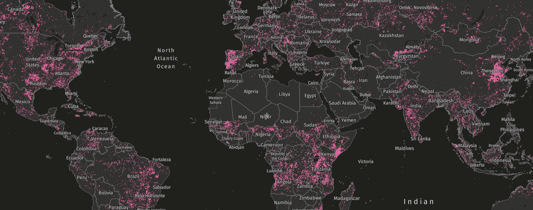
GFW’s integrated alerts layer combines the power of four alert systems for an improved view of deforestation and other vegetation disturbances globally.