See What’s Driving Deforestation Alerts for the First Time on Global Forest Watch
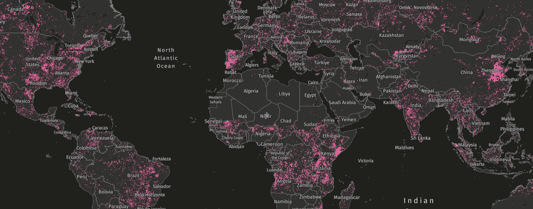
Global Forest Watch’s (GFW) deforestation alerts provide information about loss of tree cover in near-real-time, making them a critical tool for those working to combat deforestation. Existing alerts on GFW have been used to help Indigenous and local communities protect their forests, halt and prosecute environmental crimes and protect threatened wildlife.
However, in the past, alerts only let users know there’s been a disturbance without identifying a cause, other than a few limited classes such as fires.
Now, new drivers of deforestation alerts data is available on GFW that shows the causes of alerts across the tropics. This innovative data set uses an AI method to assign drivers to GFW’s integrated deforestation alerts in the three major forested regions in the tropics, allowing users to see what’s driving loss in near-real-time in these regions for the first time.
Critically, this information helps users distinguish between tree cover loss from natural and human causes, enabling more targeted action from those managing forests and reducing the need for costly field visits. Further, the data also provides more rapid information to estimate ecological impacts and supports better understanding of carbon emissions related to forest disturbances.
What does the drivers of deforestation alerts data show?
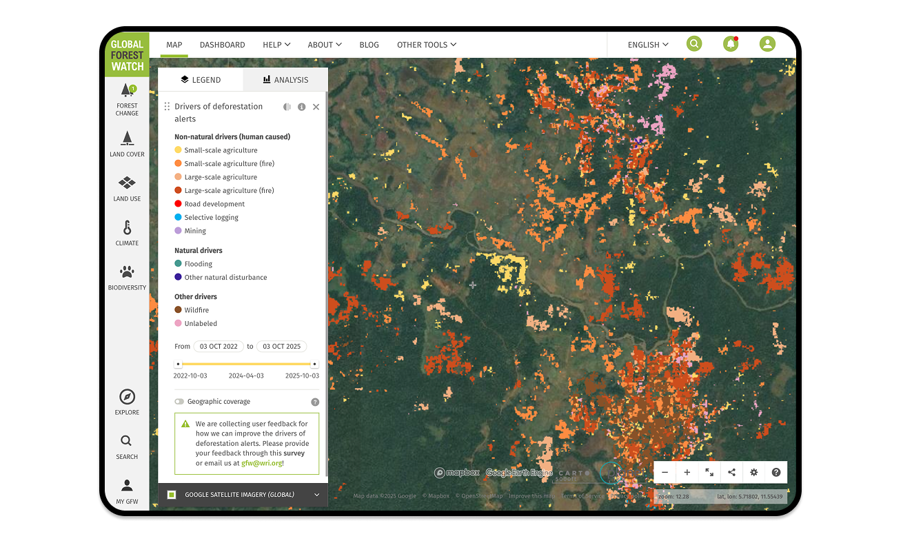
Driver classes
The data classifies GFW’s near-real-time integrated deforestation alerts into 11 natural and human-caused driver classes at 10-meter resolution:
Geographic coverage
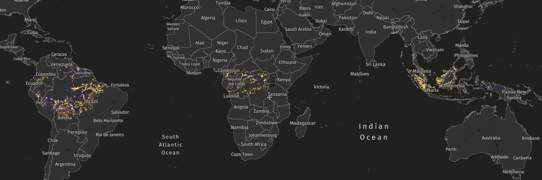
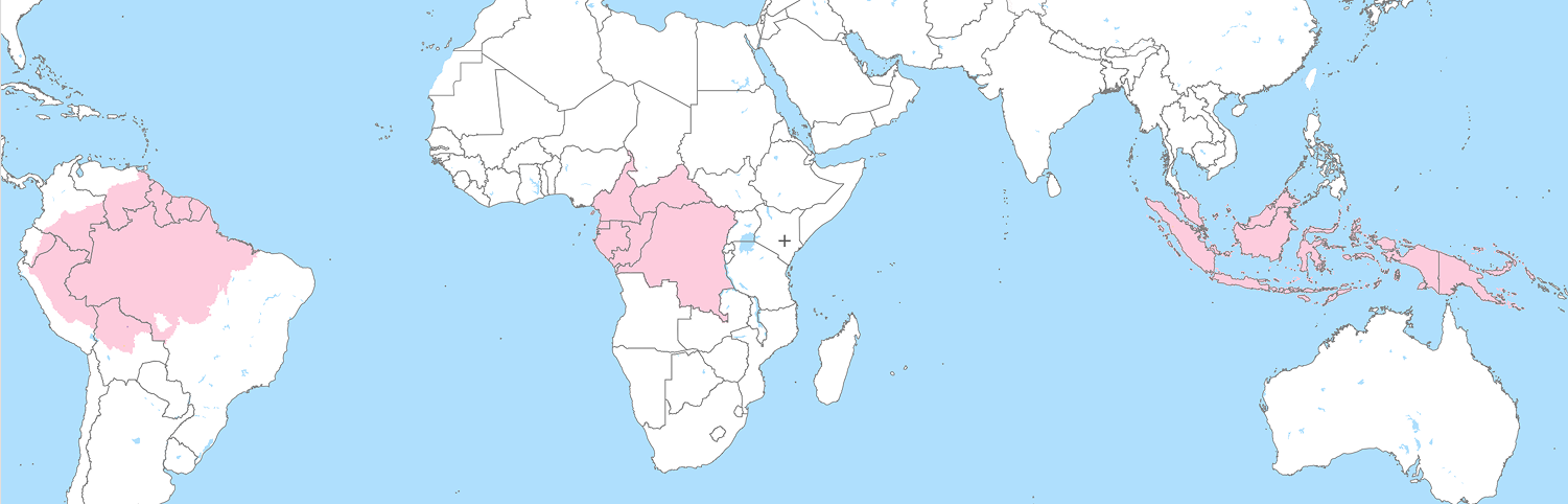
The data covers the three major forest basins of the tropics in the Amazon, Congo and Indonesia, which cover around one third of the world’s land surface and include 80% of the world’s tropical forests.
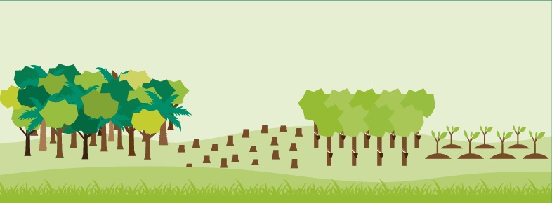
Tropical forests are some of the most important forest ecosystems, critical for livelihoods, carbon storage, water provision, biodiversity and more, and are under threat from deforestation.
Temporal coverage and update frequency
Currently, data is available for alerts detected from 2022-2024, but the algorithm will soon be adapted to run on a monthly basis. In this near-real-time setup, each new alert is classified within 31 days of detection, and every month the model reprocesses alerts from the previous three months on a rolling basis. Classifications are only displayed if they are confidently classified by the algorithm, and labels may be updated if a more confident classification becomes available. As a result, each alert can be reclassified up to three times, with the layer showing the most confident classification. This process allows accuracy to improve over time as additional satellite imagery and context become available. Additionally, some drivers (e.g., selective logging and road development) are best identified soon after the canopy is disturbed, while other drivers (e.g., mining or agriculture) may take longer for their characteristic signals to appear.
How was the data developed?
The integrated deforestation alerts at 10-meter resolution are the basis for the driver classifications. Integrated alerts combine the power of GLAD-L, GLAD-S2 and RADD deforestation alerts to provide a faster, more confident view of forest disturbances than any one individual system.
To apply driver classifications to the integrated deforestation alerts, we used a deep learning model first developed for Suriname, the Republic of Congo and the Democratic Republic of the Congo. The model was trained on an extensive data set of forest disturbance events in the Amazon, Congo and Southeast Asian rainforests using visual interpretation of high-resolution Planet imagery to assign classification labels. The model uses post-disturbance Sentinel-1 and Sentinel-2 satellite imagery for the driver classifications, integrating the complementary strengths of radar and optical satellite data. This means that the model can classify drivers rapidly, even in cloudy conditions.
To identify where fire coincided with clearing of agricultural land — a commonly used agricultural management technique in the tropics — we used VIIRS fire alerts and Normalized Burn Ratio (information that identifies burned areas) from Sentinel-2.
To reduce noise in the data, we carried out smoothing:
- First, alert pixels not exceeding 0.75 confidence were attributed as uncertain classifications and set to ‘unlabeled.’
- Second, for each distinct alert patch (i.e. a spatially connected group of alert pixels), the dominant driver was selected and attributed to the entire patch, with a few exceptions for drivers occurring at a finer, pixel-level scale (road development and selective logging) and for extremely large patches.
The accuracy of the classifications varies by region, with the Congo Basin having the highest overall performance. Most misclassifications are related to confusion between agriculture and mining, which often occur in the same area, and between flooding and wildfires in floodplains.
Learn more here about the methodology and limitations.
How does the data compare to other data showing drivers of loss?
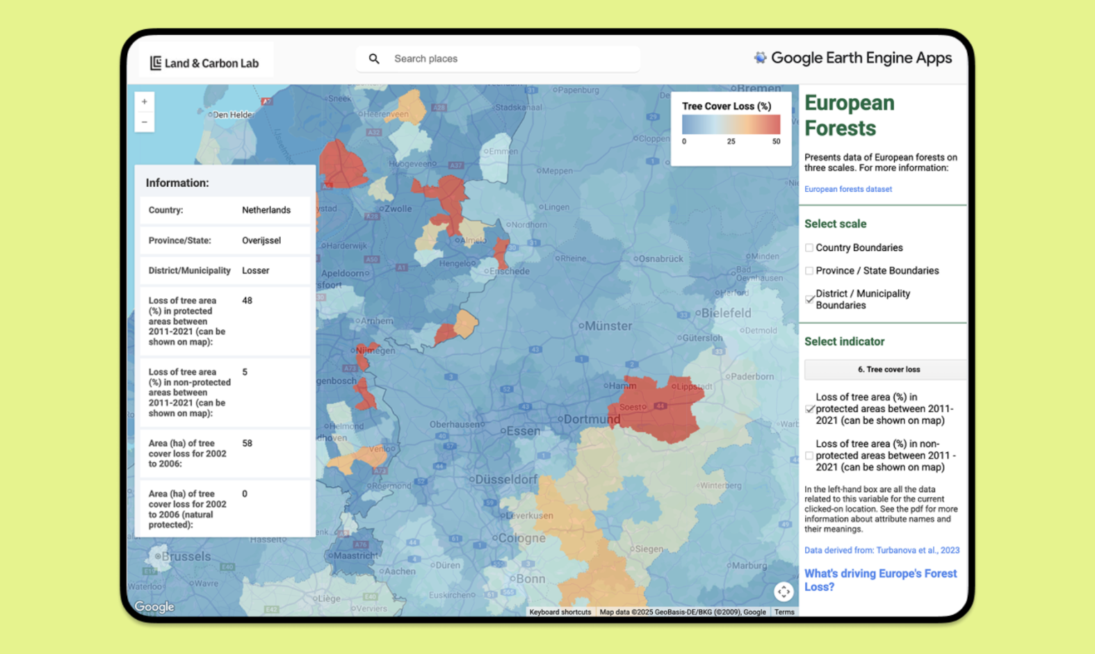
Other data sets from GFW and Land & Carbon Lab provide information on drivers of vegetation disturbances, but vary in terms of their detail, timeframe and update frequency, and therefore have different applications. For example, the 1-km annual drivers of tree cover loss data available on GFW is more suited for historical analysis over many years, and the Land Disturbance Alert Classification System from Land & Carbon Lab provides information on vegetation disturbances both inside and outside of forests globally.
Some attributes make the data sets more suitable for specific applications. For example, higher resolution allows more insight into co-occurrence of drivers in local areas, and sub-annual information allows insights into the seasonality of different drivers:
How can the data be used? A vital source for forest protectors
Deforestation alerts are used around the world by hundreds of Indigenous Peoples and local communities, as well as forest rangers and NGOs, to investigate potential unplanned or illegal disturbances in forests.
However, different causes for disturbances warrant different responses. For example, in the case of agricultural conversion, users may want to investigate the loss to assess the legality of the clearing. In the case of a natural disturbance such as a landslide, either no investigation or a different sort of investigation would be required. Users can reference the drivers of deforestation alerts data to determine what type of response is appropriate depending on the cause of the disturbance.
While field visits or the use of high-resolution satellite imagery to check classifications may still be required in some instances to plan appropriate action or to fully understand the context, the addition of driver information on GFW enables alert prioritization and more targeted action, saving resources and allowing investigations to be focused on more concerning losses.
The data can also be used to improve understanding of carbon emissions from forest disturbances. Some types of conversion clear all the vegetation from the land, whereas others leave trees behind. In addition, information on the cause of loss is required to estimate emissions from the subsequent land use after the forest has been cleared. It also indicates whether regrowth can be expected, which is likely after logging activities but not after conversion to permanent agriculture, for example.
What’s next for the drivers of deforestation alerts data?
Monthly updates: The 2025 data will be made available in early 2026, after which monthly updates will be available from 2026 onwards.
Expansion to the whole of the tropics: We soon plan to expand the data across the full coverage of the integrated deforestation alerts (currently 30 degrees north to 30 degrees south). In the future, the model may be applied to disturbances in temperate and boreal forests as well. Further research could also allow disturbances of other vegetation types to be classified using a similar approach.
Integration with other GFW tools: We plan to add the data to Forest Watcher to make it more accessible to forest protectors working in the field.
Stay tuned for more updates as we continue to improve drivers of deforestation alerts for greater coverage, access and application, and visit the Help Center to learn more.
Explore More Articles
Looking for the Quickest Signal of Deforestation or Vegetation Disturbance Globally? Turn to GFW’s Integrated Disturbance Alerts
GFW’s integrated alerts layer combines the power of four alert systems for an improved view of deforestation and other vegetation disturbances globally.